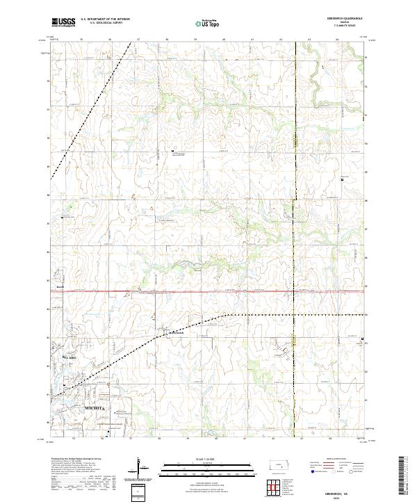
2022 Map of Greenwich
USGS Topo · Published 2022About this map
Greenwich and Kechi anchor this northeast portion of the Sedgwick County landscape, where the agricultural grid meets the expanding reach of northeastern Wichita. The terrain is defined by the winding drainages of Whitewater Cr and Prairie Cr, which cut through the rectilinear road network of the Kansas prairie. In the southwest corner, the suburban development of Bel Aire and the educational campus of Wichita State University Technical signal the area's modern shift from rural farming to specialized aviation and technical industries, highlighted by the prominence of the Colonel James Jabara Airport.
Find a feature on this map
82 named features on this map. Tap any name to fly to it.
Don’t see what you’re looking for? This feature index may not catch every label — zoom into the map to look around manually.
Map Details
Editions of this 2022 Greenwich Map
This is the sole edition of this map. No revisions or reprints were ever made.
Other maps of this area

1889 · Wichita
USGS Topo · 1:125,000

1894 · Wichita
USGS Topo · 1:125,000

1941 · Valley Center
USGS Topo · 1:31,680

1942 · Valley Center
USGS Topo · 1:31,680

1943 · Wichita East
USGS Topo · 1:31,680

1945 · Andover
USGS Topo · 1:31,680

1955 · Santa Fe Lake
USGS Topo · 1:24,000

1955 · Benton
USGS Topo · 1:24,000

1955 · Greenwich
USGS Topo · 1:24,000

1955 · Wichita
USGS Topo · 1:250,000