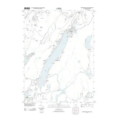
2013 Map of Greenwood Lake
USGS Topo · Published 2013About this map
Greenwood Lake serves as the central focal point of this 2013 survey, straddling the border between New York and New Jersey. The landscape is a mosaic of recreational and agricultural utility, from the expansive Masker Fruit Farms and Ochs Orchards in the north near Rocky Hill to the cluster of marinas like DeFeo's Cove Marina and Willow Point Marina along the shoreline. The transition from the settled areas of Hewitt and West Milford in the south to the more wooded terrain surrounding Sterling Lake and Bellvale Mountain illustrates the enduring topography of the Ramapo Mountains. Local history is anchored by sites like Chapel Island and legacy cemeteries including Warwick Cem and Erskine Cem, while the Greenwood Lake Airport and Hickory Hill Golf Course reflect the area's development as a regional leisure destination.
Find a feature on this map
183 named features on this map. Tap any name to fly to it.
Don’t see what you’re looking for? This feature index may not catch every label — zoom into the map to look around manually.
Map Details
Editions of this 2013 Greenwood Lake Map
This is the sole edition of this map. No revisions or reprints were ever made.
Other maps of this area

1891 · Greenwood Lake
USGS Topo · 1:62,500

1891 · Ramapo
USGS Topo · 1:62,500

1893 · Greenwood Lake
USGS Topo · 1:62,500

1893 · Ramapo
USGS Topo · 1:62,500

1902 · Schunemunk
USGS Topo · 1:62,500

1903 · Greenwood Lake
USGS Topo · 1:62,500

1906 · Goshen
USGS Topo · 1:62,500

1908 · Goshen
USGS Topo · 1:62,500

1910 · Ramapo
USGS Topo · 1:62,500

1910 · Greenwood Lake
USGS Topo · 1:62,500