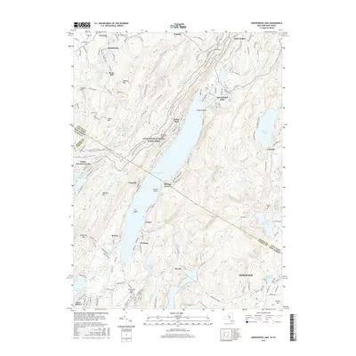
2016 Map of Greenwood Lake
USGS Topo · Published 2016About this map
The Appalachian National Scenic Trail winds through the ridgelines of Bellvale Mtn and Bearfort Mtn, tracing the border between New York and New Jersey in this mid-2010s survey. The landscape is defined by the seven-mile stretch of Greenwood Lake itself, which serves as a central artery for the surrounding communities of Lakeside, Sterling Forest, and Indian Park. At the northern end, the village of Warwick sits near Rocky Hill, while to the south, the Monksville Reservoir and Wanaque River dominate the drainage basin.
Find a feature on this map
155 named features on this map. Tap any name to fly to it.
Don’t see what you’re looking for? This feature index may not catch every label — zoom into the map to look around manually.
Map Details
Editions of this 2016 Greenwood Lake Map
This is the sole edition of this map. No revisions or reprints were ever made.
Other maps of this area

1891 · Greenwood Lake
USGS Topo · 1:62,500

1891 · Ramapo
USGS Topo · 1:62,500

1893 · Greenwood Lake
USGS Topo · 1:62,500

1893 · Ramapo
USGS Topo · 1:62,500

1902 · Schunemunk
USGS Topo · 1:62,500

1903 · Greenwood Lake
USGS Topo · 1:62,500

1906 · Goshen
USGS Topo · 1:62,500

1908 · Goshen
USGS Topo · 1:62,500

1910 · Ramapo
USGS Topo · 1:62,500

1910 · Greenwood Lake
USGS Topo · 1:62,500