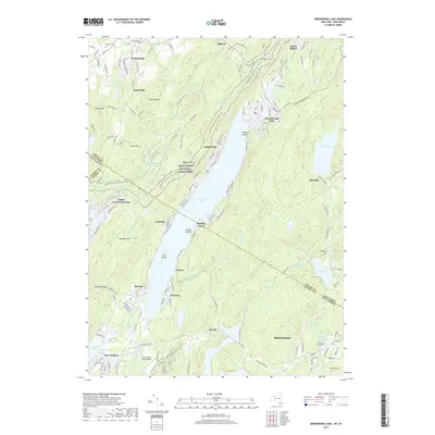
2019 Map of Greenwood Lake
USGS Topo · Published 2019About this map
Greenwood Lake serves as the focal point for this borderland geography, spanning the line between Orange County, New York, and Passaic County, New Jersey. The 2019 survey documents a landscape of recreational waters and residential clusters, including Upper Greenwood Lake and Lakeside. The northeastern corner is anchored by the village of Warwick, where Warwick Cem and Saint Stephens Cem provide critical reference points for local genealogy.
Find a feature on this map
166 named features on this map. Tap any name to fly to it.
Don’t see what you’re looking for? This feature index may not catch every label — zoom into the map to look around manually.
Map Details
Editions of this 2019 Greenwood Lake Map
This is the sole edition of this map. No revisions or reprints were ever made.
Other maps of this area

1891 · Greenwood Lake
USGS Topo · 1:62,500

1891 · Ramapo
USGS Topo · 1:62,500

1893 · Greenwood Lake
USGS Topo · 1:62,500

1893 · Ramapo
USGS Topo · 1:62,500

1902 · Schunemunk
USGS Topo · 1:62,500

1903 · Greenwood Lake
USGS Topo · 1:62,500

1906 · Goshen
USGS Topo · 1:62,500

1908 · Goshen
USGS Topo · 1:62,500

1910 · Ramapo
USGS Topo · 1:62,500

1910 · Greenwood Lake
USGS Topo · 1:62,500