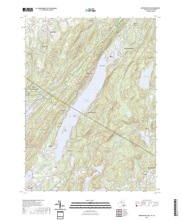
2023 Map of Greenwood Lake
USGS Topo · Published 2023About this map
Greenwood Lake straddles the border between New York and New Jersey, serving as the central anchor for a landscape defined by state lines and conservation areas. The Appalachian National Scenic Trail winds across Bellvale Mountain and near Mount Peter, providing a glimpse into the long-distance hiking corridor as it navigates the high ground above Warwick. To the east, the extensive boundaries of Sterling Forest and Sterling Forest Lake dominate the terrain, preserving the character of the highlands near the Sterling Cem.
Find a feature on this map
55 named features on this map. Tap any name to fly to it.
Don’t see what you’re looking for? This feature index may not catch every label — zoom into the map to look around manually.
Map Details
Editions of this 2023 Greenwood Lake Map
This is the sole edition of this map. No revisions or reprints were ever made.
Other maps of this area

1891 · Greenwood Lake
USGS Topo · 1:62,500

1891 · Ramapo
USGS Topo · 1:62,500

1893 · Greenwood Lake
USGS Topo · 1:62,500

1893 · Ramapo
USGS Topo · 1:62,500

1902 · Schunemunk
USGS Topo · 1:62,500

1903 · Greenwood Lake
USGS Topo · 1:62,500

1906 · Goshen
USGS Topo · 1:62,500

1908 · Goshen
USGS Topo · 1:62,500

1910 · Ramapo
USGS Topo · 1:62,500

1910 · Greenwood Lake
USGS Topo · 1:62,500