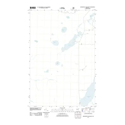
2011 Map of Greenwood Lake West
USGS Topo · Published 2011About this map
Greenwood Lake and the surrounding Superior National Forest landscape dominate this 2011 survey of Lake County, Minnesota. The terrain is defined by a dense network of glacial lakes and wetlands, including the elongated profile of Sand Lake and the smaller, isolated basins of Bonga Lake, Lobo Lake, and Cougar Lake. The hydrology of the area is further marked by the headwaters of Ridgepole Creek and the East River, showing the natural drainage patterns of this northern wilderness before it reaches the larger Superior basin.
Find a feature on this map
15 named features on this map. Tap any name to fly to it.
Don’t see what you’re looking for? This feature index may not catch every label — zoom into the map to look around manually.
Map Details
Editions of this 2011 Greenwood Lake West Map
This is the sole edition of this map. No revisions or reprints were ever made.
Other maps of this area

1952 · Babbitt SE
USGS Topo · 1:24,000

1952 · Babbitt NE
USGS Topo · 1:24,000

1953 · Whyte
USGS Topo · 1:62,500

1954 · Greenwood Lake
USGS Topo · 1:62,500

1954 · Two Harbors
USGS Topo · 1:250,000

1957 · Two Harbors
USGS Topo · 1:250,000

1957 · Brimson
USGS Topo · 1:62,500

1958 · Two Harbors
USGS Topo · 1:250,000

1964 · Two Harbors
USGS Topo · 1:250,000

1976 · Two Harbors
USGS Topo · 1:100,000