
1936 Map of Greenwood
USGS Topo · Published 1936About this map
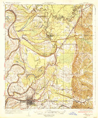
Greenwood stands as the central hub of this 1930s Mississippi Delta landscape, positioned where the Tallahatchie River and Yalobusha River converge to form the Yazoo River. The map reveals an intricate fluvial geography of meander scars and oxbows, including Old Orchard Lake and Sixmile Lake, which define the fertile but flood-prone terrain. The settlement pattern is deeply tied to the Yazoo and Mississippi Valley Railroad, with small landings and stations like Ruby Sta, Geren PO, and Money serving as critical nodes for the cotton economy.
Find a feature on this map
85 named features on this map. Tap any name to fly to it.
Don’t see what you’re looking for? This feature index may not catch every label — zoom into the map to look around manually.
Map Details
Editions of this 1936 Greenwood Map
2 editions found
Other maps of this area

1931 · Schlater
USGS Topo · 1:48,000

1931 · Sumner
USGS Topo · 1:48,000

1932 · Philipp
USGS Topo · 1:48,000

1934 · Schlater
USGS Topo · 1:62,500

1935 · Sumner
USGS Topo · 1:62,500

1935 · Philipp
USGS Topo · 1:62,500

1939 · Schlater
USGS Topo · 1:62,500

1939 · Sumner
USGS Topo · 1:62,500

1939 · Philipp
USGS Topo · 1:62,500

1940 · Seven Pines
USGS Topo · 1:62,500