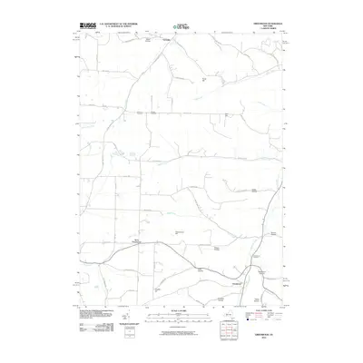
2010 Map of Greenwood
USGS Topo · Published 2010About this map
Greenwood and Hartsville anchor this rural Steuben County landscape, where the terrain is defined by a dense network of named ridges and drainage valleys. Settlement patterns follow the winding paths of Bennetts Creek and Dyke Creek, with the smaller community of West Greenwood situated along the western valley floor. The map provides significant detail for genealogists, identifying the Greenwood Cemetery and Call Hill Cemetery, alongside numerous family-named topographical features such as Purdy Hill, Dryden Hill, and Woodward Hollow. The upland areas are largely traversed by a grid of local routes like Lane School Rd and Bearlick Hollow Rd, connecting remote farmsteads and agricultural plots like the Stephens Tree Farm. This survey captures the region's enduring character as a patchwork of wooded hillsides and creek-bottom homesteads, preserved in the intricate network of hollows including Christian Hollow and Norton Hollow.
Find a feature on this map
58 named features on this map. Tap any name to fly to it.
Don’t see what you’re looking for? This feature index may not catch every label — zoom into the map to look around manually.
Map Details
Editions of this 2010 Greenwood Map
This is the sole edition of this map. No revisions or reprints were ever made.
Other maps of this area

1915 · Hornell
USGS Topo · 1:62,500

1916 · Canaseraga
USGS Topo · 1:62,500

1918 · Hornell
USGS Topo · 1:62,500

1926 · Wellsville
USGS Topo · 1:62,500

1926 · Greenwood
USGS Topo · 1:62,500

1940 · Canaseraga
USGS Topo · 1:62,500

1950 · Elmira
USGS Topo · 1:250,000

1954 · South Canisteo
USGS Topo · 1:24,000

1954 · Troupsburg
USGS Topo · 1:24,000
1954 · Canisteo
USGS Topo · 1:24,000