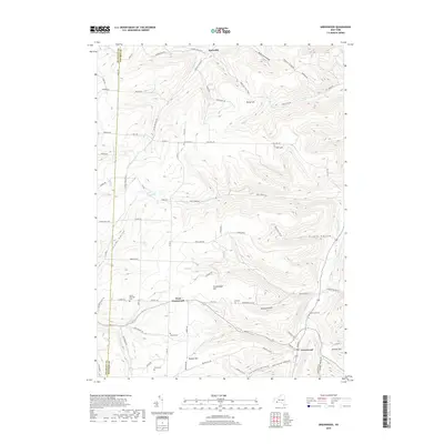
2019 Map of Greenwood
USGS Topo · Published 2019About this map
Greenwood and West Greenwood sit within a landscape of deeply cut hollows and high points near the Allegany and Steuben County line. The terrain is defined by a series of north-south ridges and drainage systems, including Bennetts Creek and Purdy Hill Fall Creek. This 2019 survey shows the continued importance of agricultural and family-named landmarks in the region, with numerous burial grounds such as the Anson Brewster Cemetery and Krusen Cemetery preserved across the hillsides. The network of roads, including County Road 61 and Call Hill Road, follows the natural contours of the land, connecting small settlements like Hartsville and Call-Hill across the prominent rises of Purdy Hill and Greenwood Hill. This map reflects the enduring rural character of the Southern Tier, where family names are often etched into both the landscape and local history.
Find a feature on this map
78 named features on this map. Tap any name to fly to it.
Don’t see what you’re looking for? This feature index may not catch every label — zoom into the map to look around manually.
Map Details
Editions of this 2019 Greenwood Map
This is the sole edition of this map. No revisions or reprints were ever made.
Other maps of this area

1915 · Hornell
USGS Topo · 1:62,500

1916 · Canaseraga
USGS Topo · 1:62,500

1918 · Hornell
USGS Topo · 1:62,500

1926 · Wellsville
USGS Topo · 1:62,500

1926 · Greenwood
USGS Topo · 1:62,500

1940 · Canaseraga
USGS Topo · 1:62,500

1950 · Elmira
USGS Topo · 1:250,000

1954 · South Canisteo
USGS Topo · 1:24,000

1954 · Troupsburg
USGS Topo · 1:24,000
1954 · Canisteo
USGS Topo · 1:24,000