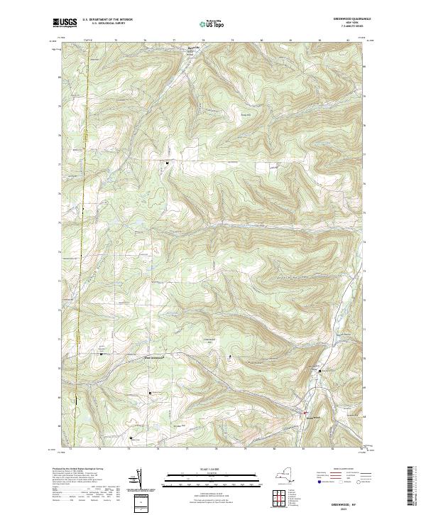
2023 Map of Greenwood
USGS Topo · Published 2023About this map
The hills and hollows of southern Steuben County define the landscape of Greenwood, where deep valleys like Erskin Hollow and Shovel Hollow cut through the high ground of Greenwood Hill and Jackson Hill. This 2023 survey illustrates a rural settlement pattern focused along the watercourses of Dyke Creek and Bennetts Creek. Family history and local heritage are preserved in numerous small burial grounds scattered across the terrain, including the Anson Brewster Cem and Letts Cem. The border between Allegany Co and Steuben Co runs along the western edge of the map, marking a transition in this highland region. Winding mountain roads like Call Hill Rd and Purdy Hill Rd connect the small hamlets of Hartsville and West Greenwood, following the natural contours of the land.
Find a feature on this map
87 named features on this map. Tap any name to fly to it.
Don’t see what you’re looking for? This feature index may not catch every label — zoom into the map to look around manually.
Map Details
Editions of this 2023 Greenwood Map
This is the sole edition of this map. No revisions or reprints were ever made.
Other maps of this area

1915 · Hornell
USGS Topo · 1:62,500

1916 · Canaseraga
USGS Topo · 1:62,500

1918 · Hornell
USGS Topo · 1:62,500

1926 · Wellsville
USGS Topo · 1:62,500

1926 · Greenwood
USGS Topo · 1:62,500

1940 · Canaseraga
USGS Topo · 1:62,500

1950 · Elmira
USGS Topo · 1:250,000

1954 · South Canisteo
USGS Topo · 1:24,000

1954 · Troupsburg
USGS Topo · 1:24,000
1954 · Canisteo
USGS Topo · 1:24,000