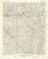
1938 Map of Greer
USGS Topo · Published 1938About this map
Industrial textile production and agricultural roots define the Upstate South Carolina landscape of the mid-1930s. The town of Greer and the settlement of Lyman stand as prominent hubs along the Southern Ry corridor, while the Piedmont and Northern Electric Ry provides vital interurban connectivity for workers at sites like the Jackson Mill. This survey captures a network of rural schoolhouses and churches that anchored local life, including Woods Chapel, Washington Sch, and Shady Grove Sch. The topography is intricately carved by the South Tiger River, Middle Tiger River, and North Tiger River, which converge in a region still heavily reliant on river crossings like Dantzler Bridge and Rogers Bridge. A CCC Camp reflects New Deal-era infrastructure work amidst the rolling hills of the Greenville and Spartanburg county line.
Find a feature on this map
94 named features on this map. Tap any name to fly to it.
Don’t see what you’re looking for? This feature index may not catch every label — zoom into the map to look around manually.
Map Details
Editions of this 1938 Greer Map
3 editions found
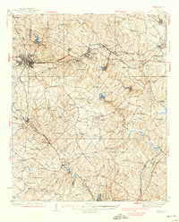
Other maps of this area

1907 · Saluda
USGS Topo · 1:125,000

1935 · Greer
USGS Topo · 1:48,000

1935 · Greenville
USGS Topo · 1:48,000

1938 · Greenville
USGS Topo · 1:62,500

1938 · Greer
USGS Topo · 1:62,500

1941 · Spartanburg
USGS Topo · 1:250,000

1947 · Spartanburg
USGS Topo · 1:62,500

1949 · Spartanburg
USGS Topo · 1:24,000

1949 · Spartanburg
USGS Topo · 1:62,500

1953 · Spartanburg
USGS Topo · 1:250,000