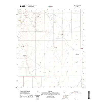
2020 Map of Greg Hills
USGS Topo · Published 2020About this map
Greg Hills and the winding course of Whiterock Canyon define this high-desert landscape where Grant, Sierra, and Luna counties converge. This 2020 survey documents the complex drainage systems of the southwestern New Mexico backcountry, including the deep incisions of Black Canyon and Macho Canyon. The survival of ranching and transit in this arid environment is written in the sparse water sources like Greg Spring and China Tank, alongside seasonal watercourses such as Macho Cr and Mule Springs Creek. An established network of rural roads, including Macho Rd and White Rock Rd, connects the high ground of the hills to the broad expanse of Chandler Draw in the south, illustrating how terrain dictates movement through this isolated borderlands region.
Find a feature on this map
27 named features on this map. Tap any name to fly to it.
Don’t see what you’re looking for? This feature index may not catch every label — zoom into the map to look around manually.
Map Details
Editions of this 2020 Greg Hills Map
This is the sole edition of this map. No revisions or reprints were ever made.
Other maps of this area

1899 · Deming
USGS Topo · 1:125,000

1915 · Deming
USGS Topo · 1:125,000

1955 · Las Cruces
USGS Topo · 1:250,000

1958 · Las Cruces
USGS Topo · 1:250,000

1961 · Nutt
USGS Topo · 1:62,500

1962 · Lake Valley
USGS Topo · 1:62,500

1964 · Florida
USGS Topo · 1:24,000

1964 · Massacre Peak
USGS Topo · 1:24,000

1972 · Good Sight Peak
USGS Topo · 1:24,000

1982 · Hatch
USGS Topo · 1:100,000