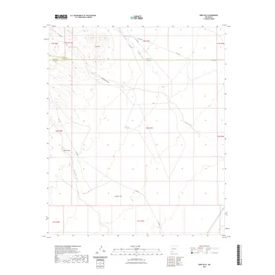
2023 Map of Greg Hills
USGS Topo · Published 2023About this map
Greg Hills rise as a prominent landform within a high-desert environment where water sources like Greg Spring and China Tank provide vital points of reference. The landscape is defined by its drainage systems, including the deeply etched Whiterock Canyon and the seasonal flows of Macho Creek and Mule Springs Creek. This terrain reflects the complex administrative geography of the region, as the boundaries for Sierra, Grant, and Luna counties all intersect in this vicinity.
Find a feature on this map
25 named features on this map. Tap any name to fly to it.
Don’t see what you’re looking for? This feature index may not catch every label — zoom into the map to look around manually.
Map Details
Editions of this 2023 Greg Hills Map
This is the sole edition of this map. No revisions or reprints were ever made.
Other maps of this area

1899 · Deming
USGS Topo · 1:125,000

1915 · Deming
USGS Topo · 1:125,000

1955 · Las Cruces
USGS Topo · 1:250,000

1958 · Las Cruces
USGS Topo · 1:250,000

1961 · Nutt
USGS Topo · 1:62,500

1962 · Lake Valley
USGS Topo · 1:62,500

1964 · Florida
USGS Topo · 1:24,000

1964 · Massacre Peak
USGS Topo · 1:24,000

1972 · Good Sight Peak
USGS Topo · 1:24,000

1982 · Hatch
USGS Topo · 1:100,000