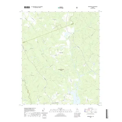
2020 Map of Greshamville
USGS Topo · Published 2020About this map
The Oconee National Forest defines the central landscape of this Greene County quadrangle, where the Oconee River and Apalahee River meet to form the northern reaches of Lake Oconee. This modern survey illustrates the persistent rural character of the area, punctuated by small settlements like Greshamville and Wrayswood. The topographic data reveals a complex network of creeks, including Little Greenbrier Cr and Ellison Cr, which feed into the river system. Family and local history is deeply embedded in the land, evidenced by numerous burial sites such as McWhorter Cem, Greshamville Cem, and Brown-Jones Cem. The presence of Watson Spring and the crossing at Trimble Bridge further mark the transition from the rolling timberland to the water-dominated south, providing a detailed look at the interface between managed forest and the reservoirs created by regional hydro-infrastructure.
Find a feature on this map
56 named features on this map. Tap any name to fly to it.
Don’t see what you’re looking for? This feature index may not catch every label — zoom into the map to look around manually.
Map Details
Editions of this 2020 Greshamville Map
This is the sole edition of this map. No revisions or reprints were ever made.
Other maps of this area

1953 · Athens
USGS Topo · 1:250,000

1958 · Athens
USGS Topo · 1:250,000

1959 · Athens
USGS Topo · 1:250,000

1963 · Athens
USGS Topo · 1:250,000

1964 · Barnett Shoals
USGS Topo · 1:24,000

1964 · Watkinsville
USGS Topo · 1:24,000

1971 · Maxeys
USGS Topo · 1:24,000

1972 · Penfield
USGS Topo · 1:24,000

1972 · Buckhead
USGS Topo · 1:24,000

1972 · Apalachee
USGS Topo · 1:24,000