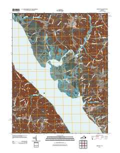
2011 Map of Gressitt
USGS Topo · Published 2011About this map
The York River dominates this coastal landscape, carving out a complex network of bays and landings that define the maritime character of the region. Numerous waterfront access points such as Miller Landing, Red Bank Landing, and Capahosic Landing suggest a deep-rooted reliance on river transport and fishing. To the north, the transition from tidal waters to interior drainage is marked by the sprawling Poropotank River and its associated wetlands, including Woods Mill Swamp and Meadow Swamp.
Find a feature on this map
87 named features on this map. Tap any name to fly to it.
Don’t see what you’re looking for? This feature index may not catch every label — zoom into the map to look around manually.
Map Details
Editions of this 2011 Gressitt Map
This is the sole edition of this map. No revisions or reprints were ever made.
Other maps of this area

1906 · Williamsburg
USGS Topo · 1:62,500

1917 · Urbanna
USGS Topo · 1:62,500

1917 · Toano
USGS Topo · 1:62,500

1918 · Toano
USGS Topo · 1:62,500

1919 · New Kent
USGS Topo · 1:62,500

1943 · Richmond
USGS Topo · 1:250,000
1949 · Saluda
USGS Topo · 1:24,000

1949 · Shacklefords
USGS Topo · 1:24,000

1949 · Richmond
USGS Topo · 1:250,000

1950 · West Point
USGS Topo · 1:24,000