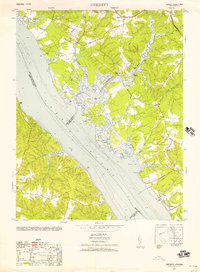
1952 Map of Gressitt
USGS Topo · Published 1957About this map
The York River and its winding tributaries define the landscape of this 1952 coastal Virginia survey. The map details a network of river landings such as Red Bank Landing, Haywood Landing, and Partridge Landing along the Poropotank River, illustrating the importance of water-based transport and the local oyster industry indicated near Belleview. Significant landward features include Woods Mill near the northern boundary and the Prospect School situated between Gressitt and Plain View.
Find a feature on this map
47 named features on this map. Tap any name to fly to it.
Don’t see what you’re looking for? This feature index may not catch every label — zoom into the map to look around manually.
Map Details
Editions of this 1952 Gressitt Map
This is the sole edition of this map. No revisions or reprints were ever made.
Other maps of this area

1906 · Williamsburg
USGS Topo · 1:62,500

1917 · Urbanna
USGS Topo · 1:62,500

1917 · Toano
USGS Topo · 1:62,500

1918 · Toano
USGS Topo · 1:62,500

1919 · New Kent
USGS Topo · 1:62,500

1943 · Richmond
USGS Topo · 1:250,000
1949 · Saluda
USGS Topo · 1:24,000

1949 · Shacklefords
USGS Topo · 1:24,000

1949 · Richmond
USGS Topo · 1:250,000

1950 · West Point
USGS Topo · 1:24,000