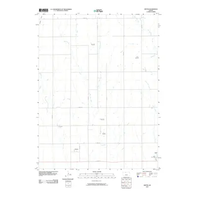
2009 Map of Gretna
USGS Topo · Published 2009About this map
Gretna and Agra anchor the southeastern portion of this Phillips County landscape, situated along a transportation corridor that cuts through the agricultural heartland. The terrain is defined by a dense network of seasonal drainages, including Big Creek to the west and the multiple branches of Plum Creek at the center. These waterways dictate the local geography, flowing around prominent landmarks like Blue Mound and leading toward the Agra City Dam.
Find a feature on this map
29 named features on this map. Tap any name to fly to it.
Don’t see what you’re looking for? This feature index may not catch every label — zoom into the map to look around manually.
Map Details
Editions of this 2009 Gretna Map
This is the sole edition of this map. No revisions or reprints were ever made.
Other maps of this area

1893 · Phillipsburg
USGS Topo · 1:125,000

1955 · Beloit
USGS Topo · 1:250,000

1959 · Beloit
USGS Topo · 1:250,000

1972 · Kirwin
USGS Topo · 1:24,000

1972 · Kirwin Reservoir
USGS Topo · 1:24,000

1972 · Phillipsburg South
USGS Topo · 1:24,000

1973 · Kensington
USGS Topo · 1:24,000

1973 · Kensington NE
USGS Topo · 1:24,000

1973 · Stuttgart NE
USGS Topo · 1:24,000
1973 · Kensington NW
USGS Topo · 1:24,000