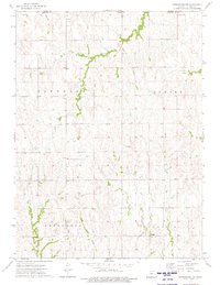
1973 Map of Kensington NW
USGS Topo · Published 1975About this map
Greenwood Cem and Matteson Cem sit among the township divisions of rural Phillips County during the early 1970s. This land, organized into the districts of Glenwood, Sumner, Greenwood, and Crystal, is defined by a dendritic drainage pattern where Crow Creek and its tributary West Crow Creek flow through the northern reaches. The landscape is primarily shaped by agriculture and the section-line roads that segment the prairie, punctuated by small family or community landmarks like Chapman Cem near Chapman Creek. In the southern half, the terrain becomes more intricate as West Plum Creek and East Plum Creek converge, illustrating the vital role of seasonal waterways in the development of north-central Kansas homesteads and townships.
Find a feature on this map
18 named features on this map. Tap any name to fly to it.
Don’t see what you’re looking for? This feature index may not catch every label — zoom into the map to look around manually.
Map Details
Editions of this 1973 Kensington NW Map
This is the sole edition of this map. No revisions or reprints were ever made.
Other maps of this area

1893 · Phillipsburg
USGS Topo · 1:125,000

1896 · Holdrege
USGS Topo · 1:125,000

1955 · Grand Island
USGS Topo · 1:250,000

1955 · Beloit
USGS Topo · 1:250,000

1957 · Grand Island
USGS Topo · 1:250,000

1958 · Grand Island
USGS Topo · 1:250,000

1959 · Beloit
USGS Topo · 1:250,000

1973 · Kensington
USGS Topo · 1:24,000

1973 · Kensington NE
USGS Topo · 1:24,000

1973 · Stuttgart NE
USGS Topo · 1:24,000