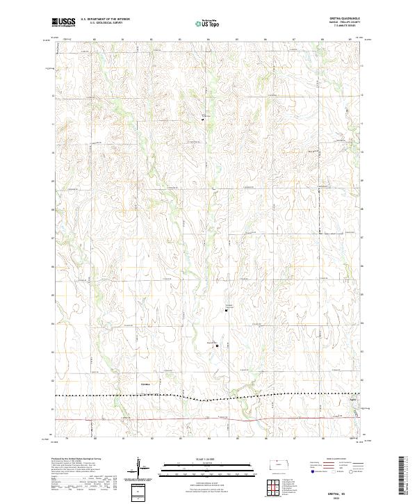
2022 Map of Gretna
USGS Topo · Published 2022About this map
Gretna and Agra anchor the southern corridor of this North Central Kansas landscape, where the agricultural grid is deeply etched into the topography of the Smoky Hills region. The drainage patterns of Big Cr and the various branches of Plum Creek, including W Plum Cr and E Plum Cr, carve a complex series of draws and valleys through the upland plains. This intricate hydrography influenced the placement of early rural institutions, evidenced by the distribution of Plum Creek Cem, Pleasant View Cem, and Edwards Cem across the township lines.
Find a feature on this map
27 named features on this map. Tap any name to fly to it.
Don’t see what you’re looking for? This feature index may not catch every label — zoom into the map to look around manually.
Map Details
Editions of this 2022 Gretna Map
This is the sole edition of this map. No revisions or reprints were ever made.
Other maps of this area

1893 · Phillipsburg
USGS Topo · 1:125,000

1955 · Beloit
USGS Topo · 1:250,000

1959 · Beloit
USGS Topo · 1:250,000

1972 · Kirwin
USGS Topo · 1:24,000

1972 · Kirwin Reservoir
USGS Topo · 1:24,000

1972 · Phillipsburg South
USGS Topo · 1:24,000

1973 · Kensington
USGS Topo · 1:24,000

1973 · Kensington NE
USGS Topo · 1:24,000

1973 · Stuttgart NE
USGS Topo · 1:24,000
1973 · Kensington NW
USGS Topo · 1:24,000