2022 Map of Gretna
USGS Topo · Published 2022About this map
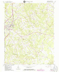
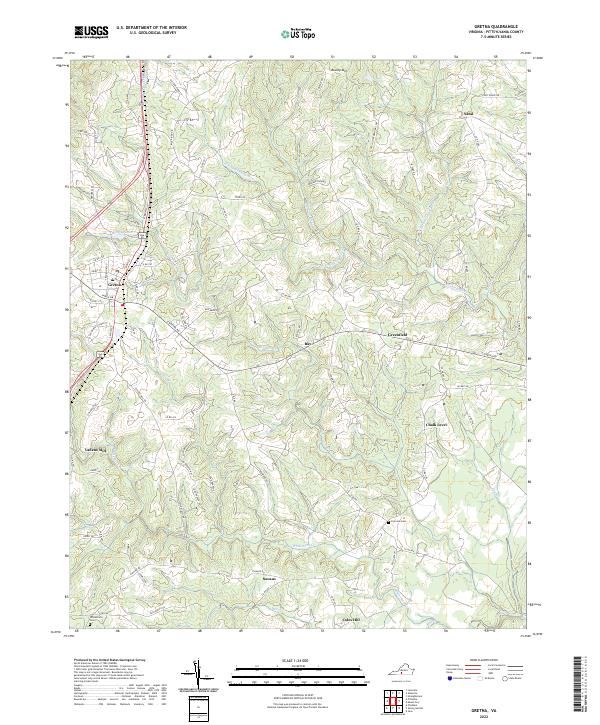
The town of Gretna serves as the focal point of this modern Pittsylvania County landscape, where the headwaters of the Stinking River and its various forks carve through the Piedmont terrain. The area is characterized by a dense network of country roads such as E Gretna Rd and Hickeys Rd, connecting long-standing rural communities including Chalk Level, Sonans, and Coles Hill. To the west, Vadens Mill and Gretna Lake indicate the importance of water management in the local economy and history.
Find a feature on this map
86 named features on this map. Tap any name to fly to it.
Don’t see what you’re looking for? This feature index may not catch every label — zoom into the map to look around manually.
Map Details
Editions of this 2022 Gretna Map
This is the sole edition of this map. No revisions or reprints were ever made.