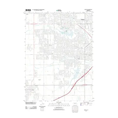
2011 Map of Gretna
USGS Topo · Published 2011About this map
The western suburbs of Omaha expand into a landscape defined by significant water management and recreation projects in this 2011 record. The map reveals a dense network of residential subdivisions spreading south and west from the city core, particularly around the large basins of Zorinsky Lake and Wehrspann Lake. These reservoirs, created by structures like the Wiebe Dam, serve as focal points for the surrounding suburban growth near the settlements of Chalco and Skyline.
Find a feature on this map
87 named features on this map. Tap any name to fly to it.
Don’t see what you’re looking for? This feature index may not catch every label — zoom into the map to look around manually.
Map Details
Editions of this 2011 Gretna Map
This is the sole edition of this map. No revisions or reprints were ever made.
Other maps of this area

1893 · Fremont
USGS Topo · 1:125,000

1896 · Fremont
USGS Topo · 1:125,000

1955 · Fremont
USGS Topo · 1:250,000

1956 · Gretna
USGS Topo · 1:24,000

1956 · Cedar Creek
USGS Topo · 1:24,000

1956 · Ralston
USGS Topo · 1:24,000

1956 · Springfield
USGS Topo · 1:24,000

1956 · Irvington
USGS Topo · 1:24,000

1957 · Fremont
USGS Topo · 1:250,000

1958 · Fremont
USGS Topo · 1:250,000