2021 Map of Gretna
USGS Topo · Published 2021About this map
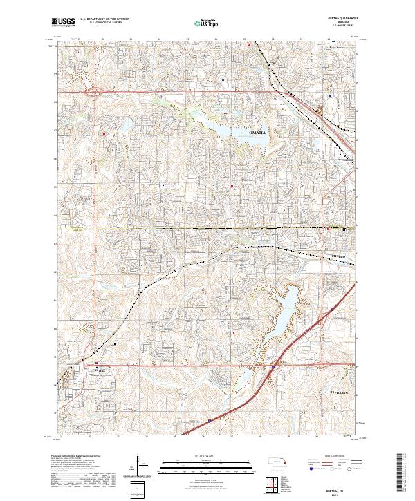
The suburban and rural landscape of eastern Nebraska is captured here as the city of Omaha expands westward across the Douglas Co Sarpy Co line. Significant water management features define the local geography, including Zorinsky Lake and the Papillion Cr Reservoir D-38, which manage the flow of the Boxelder Cr and its tributaries. These reservoirs and creeks, such as Wehrspann Cr and S Papillion Cr, provide a framework for the growing residential developments that connect the city to outlying communities.
Find a feature on this map
33 named features on this map. Tap any name to fly to it.
Don’t see what you’re looking for? This feature index may not catch every label — zoom into the map to look around manually.
Map Details
Editions of this 2021 Gretna Map
This is the sole edition of this map. No revisions or reprints were ever made.