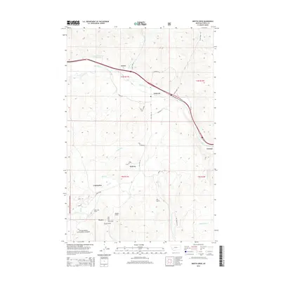
2014 Map of Griffin Creek
USGS Topo · Published 2014About this map
Clark Fork winds through this Powell County landscape, serving as a primary corridor for transportation and settlement in the early 21st century. The map illustrates a series of small, dispersed communities including Goldcreek, Garrison, and Dutton along the northern valley floor, while the southern reaches transition into the protected lands of the Deerlodge National Forest. This area is characterized by a complex network of named drainages and gulches, such as French Gulch and the phonetically distinct Sin- pul- stu- weh Gulch, which suggest a history of prospecting and geographic naming by early inhabitants. Settlements like Lingenpolter and Wall City are situated among these rugged drainages, often accessed by isolated routes like Gough Creek Rd or Eagle Creek Way. The presence of the Gold Creek Airport near Pioneer highlights the persistent utility of this corridor in a region defined by its narrow valley floors and rising mountain terrain.
Find a feature on this map
42 named features on this map. Tap any name to fly to it.
Don’t see what you’re looking for? This feature index may not catch every label — zoom into the map to look around manually.
Map Details
Editions of this 2014 Griffin Creek Map
This is the sole edition of this map. No revisions or reprints were ever made.
Other maps of this area

1889 · Helena
USGS Topo · 1:250,000

1893 · Helena
USGS Topo · 1:250,000

1899 · Helena
USGS Topo · 1:250,000

1903 · Helena
USGS Topo · 1:250,000

1908 · Philipsburg
USGS Topo · 1:125,000

1919 · Drummond
USGS Topo · 1:125,000

1921 · Drummond
USGS Topo · 1:125,000

1947 · Butte
USGS Topo · 1:250,000

1958 · Butte
USGS Topo · 1:250,000

1958 · Drummond
USGS Topo · 1:62,500