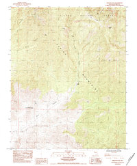
1984 Map of Griffith Peak
USGS Topo · Published 1984About this map
Spring Mountains high country dominates this mid-1980s landscape, where the ridges and deep drainages of the Toiyabe National Forest define the Clark County interior. The map illustrates a transitional period for the canyons, noting the location of the Williams Ranch and the historical footprint of the Lower Williams Ranch (Site). These sites, situated near the mouth of Trout Canyon, represent early settlement attempts in an environment shaped by water scarcity and steep elevation gains.
Find a feature on this map
18 named features on this map. Tap any name to fly to it.
Don’t see what you’re looking for? This feature index may not catch every label — zoom into the map to look around manually.
Map Details
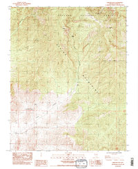
Editions of this 1984 Griffith Peak Map
2 editions found
Other maps of this area

1907 · Las Vegas
USGS Topo · 1:250,000

1908 · Las Vegas
USGS Topo · 1:250,000

1954 · Las Vegas
USGS Topo · 1:250,000

1957 · Las Vegas
USGS Topo · 1:250,000

1957 · Mt. Stirling
USGS Topo · 1:62,500

1957 · Charleston Peak
USGS Topo · 1:62,500

1957 · Mountain Springs
USGS Topo · 1:62,500
1958 · Pahrump
USGS Topo · 1:62,500

1959 · Las Vegas
USGS Topo · 1:250,000

1962 · Las Vegas
USGS Topo · 1:250,000