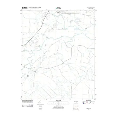
2010 Map of Grifton
USGS Topo · Published 2010About this map
Grifton serves as the northern anchor of this landscape, where Contentnea Creek meanders toward its confluence with the Neuse River. The map reveals a river-centered topography defined by numerous historical river access points, including Jollys Old Field Landing, Plank Landing, and Bectons Old-Field Landing. These named landings, alongside Nelson Landing and Caswell Landing, point to the enduring significance of waterborne transit and recreation in this part of North Carolina.
Find a feature on this map
60 named features on this map. Tap any name to fly to it.
Don’t see what you’re looking for? This feature index may not catch every label — zoom into the map to look around manually.
Map Details
Editions of this 2010 Grifton Map
This is the sole edition of this map. No revisions or reprints were ever made.
Other maps of this area

1902 · Ayden
USGS Topo · 1:62,500

1903 · Trent River
USGS Topo · 1:62,500

1904 · Ayden
USGS Topo · 1:62,500

1904 · Trent River
USGS Topo · 1:62,500

1914 · Kinston
USGS Topo · 1:48,000

1916 · Kinston
USGS Topo · 1:62,500

1953 · Rocky Mount
USGS Topo · 1:250,000

1954 · Rocky Mount
USGS Topo · 1:250,000

1958 · Deep Run
USGS Topo · 1:62,500
1980 · Rivermont
USGS Topo · 1:24,000