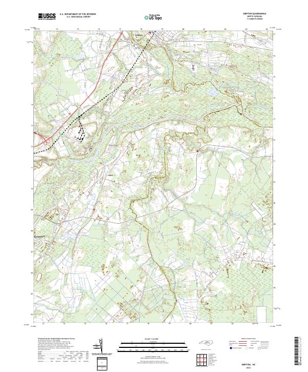
2022 Map of Grifton
USGS Topo · Published 2022About this map
Grifton sits at the northern edge of this coastal plain landscape, where the confluence of Contentnea Creek and the Neuse River defines the local geography. The map reveals a complex network of hydrological modifications, including the Rhem Canal, Buckleberry Canal, and Cox Canal, which reflect long-standing efforts to manage the low-lying terrain and expansive wetlands like Eagle Swamp. These drainage systems often parallel established travel routes such as British Rd and Seth West Rd, illustrating how the agricultural and settlement patterns were shaped by the water.
Find a feature on this map
82 named features on this map. Tap any name to fly to it.
Don’t see what you’re looking for? This feature index may not catch every label — zoom into the map to look around manually.
Map Details
Editions of this 2022 Grifton Map
This is the sole edition of this map. No revisions or reprints were ever made.
Other maps of this area

1902 · Ayden
USGS Topo · 1:62,500

1903 · Trent River
USGS Topo · 1:62,500

1904 · Ayden
USGS Topo · 1:62,500

1904 · Trent River
USGS Topo · 1:62,500

1914 · Kinston
USGS Topo · 1:48,000

1916 · Kinston
USGS Topo · 1:62,500

1953 · Rocky Mount
USGS Topo · 1:250,000

1954 · Rocky Mount
USGS Topo · 1:250,000

1958 · Deep Run
USGS Topo · 1:62,500
1980 · Rivermont
USGS Topo · 1:24,000