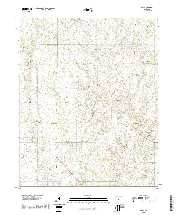
2022 Map of Grimes
USGS Topo · Published 2022About this map
The settlement of Grimes sits in the high plains of western Oklahoma, marking the transition between Roger Mills and Beckham counties. This 2022 survey illustrates a landscape defined by an extensive grid of section roads and a network of seasonal watercourses. Genealogists can locate several remote burial grounds, including Brookside Cem near the headwaters of Middle Buffalo Cr and Buffalo Cem further south. The drainage patterns of Buffalo Cr and Starvation Cr dictate the local topography, while man-made features like the Shirley Thompson Reservoir and McLaury Number 2 Reservoir indicate contemporary water management in this agricultural region. The map provides a precise record of the section-line road system, featuring routes such as N 1750 RD and ew107 RD that connect the scattered rural homesteads of the panhandle borderlands.
Find a feature on this map
45 named features on this map. Tap any name to fly to it.
Don’t see what you’re looking for? This feature index may not catch every label — zoom into the map to look around manually.
Map Details
Editions of this 2022 Grimes Map
This is the sole edition of this map. No revisions or reprints were ever made.
Other maps of this area

1955 · Clinton
USGS Topo · 1:250,000

1957 · Clinton
USGS Topo · 1:250,000

1960 · Sweetwater
USGS Topo · 1:62,500

1960 · Cheyenne
USGS Topo · 1:62,500

1960 · Sayre
USGS Topo · 1:62,500

1961 · Reydon
USGS Topo · 1:62,500

1984 · Foss Reservoir
USGS Topo · 1:100,000

1985 · Elk City
USGS Topo · 1:100,000
1988 · Grimes
USGS Topo · 1:24,000

1988 · Dempsey
USGS Topo · 1:24,000