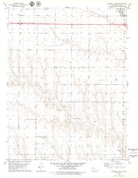
1979 Map of Grinnell South
USGS Topo · Published 1979About this map
The Union Pacific railroad corridor and parallel highways 70 and 40 define the northern landscape of this High Plains region, where the town of Grinnell sits near the tracks. To the west, the small community of Campus and the location of Bushby mark the steady progression of the rail line across the flat upland. South of this transportation corridor, the terrain breaks into more complex drainages as it descends toward Big Creek and the North Branch Hackberry Creek. This transition from the level plateau to the dissected creek valleys reveals the region's resource extraction, indicated by an Oil Well and several Gravel Pits scattered among the draws. The map encompasses portions of Gaeland and Gove, providing a detailed view of the rural infrastructure and land use in western Kansas during the late 1970s.
Find a feature on this map
16 named features on this map. Tap any name to fly to it.
Don’t see what you’re looking for? This feature index may not catch every label — zoom into the map to look around manually.
Map Details
Editions of this 1979 Grinnell South Map
This is the sole edition of this map. No revisions or reprints were ever made.
Other maps of this area

1954 · Goodland
USGS Topo · 1:250,000

1955 · Scott City
USGS Topo · 1:250,000

1956 · Goodland
USGS Topo · 1:250,000

1957 · Goodland
USGS Topo · 1:250,000

1958 · Scott City
USGS Topo · 1:250,000

1972 · Orion NE
USGS Topo · 1:24,000

1972 · Orion
USGS Topo · 1:24,000

1972 · Elkader NE
USGS Topo · 1:24,000
1979 · Oakley South
USGS Topo · 1:24,000

1979 · Grinnell NE
USGS Topo · 1:24,000