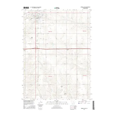
2015 Map of Grinnell South
USGS Topo · Published 2015About this map
Grinnell serves as the focal point for this section of Poweshiek County, where the sprawling campus of Grinnell Coll and the municipal infrastructure of the Grinnell Regional Airport meet the agricultural lands of central Iowa. The landscape transitions from the gridded streets of the southern city limits into a drainage network defined by the N English River, English Cr, and Little Bear Cr. This transition reveals a history of rural community life preserved in a dense collection of burial grounds, including the Norwegian Lutheran Cem and Hazelwood Cem. Historical transportation routes like Stagecoach Rd and Lang Creek Ave cut across the modern township lines of t80n r16w and t79n r16w, illustrating how early travel ways were integrated into the established section-line road system that still defines the region's movement and property boundaries today.
Find a feature on this map
79 named features on this map. Tap any name to fly to it.
Don’t see what you’re looking for? This feature index may not catch every label — zoom into the map to look around manually.
Map Details
Editions of this 2015 Grinnell South Map
This is the sole edition of this map. No revisions or reprints were ever made.
Other maps of this area

1954 · Des Moines
USGS Topo · 1:250,000

1956 · Des Moines
USGS Topo · 1:250,000

1957 · Des Moines
USGS Topo · 1:250,000

1969 · Des Moines
USGS Topo · 1:250,000

1979 · Montezuma
USGS Topo · 1:24,000

1979 · Searsboro
USGS Topo · 1:24,000

1979 · Grinnell South
USGS Topo · 1:24,000
1979 · Malcom
USGS Topo · 1:24,000

1980 · Newburg
USGS Topo · 1:24,000

1980 · Sully
USGS Topo · 1:24,000