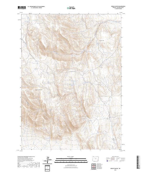
2023 Map of Groan Canyon
USGS Topo · Published 2023About this map
Groan Canyon and the surrounding high desert of Malheur County are defined by a network of seasonal water catchments and isolated springs essential for land management. This 2023 survey illustrates a landscape of complex topography, where the Palomino Hills and Sheepshead Mountains overlook deeply incised drainages like Bone Canyon and Mickey Canyon. The distribution of water is a central theme, documented through numerous named reservoirs including Arrowhead Reservoir Number One, Arrowhead Reservoir Number Two, and Hub Reservoir.
Find a feature on this map
29 named features on this map. Tap any name to fly to it.
Don’t see what you’re looking for? This feature index may not catch every label — zoom into the map to look around manually.
Map Details
Editions of this 2023 Groan Canyon Map
This is the sole edition of this map. No revisions or reprints were ever made.
Other maps of this area

1955 · Jordan Valley
USGS Topo · 1:250,000

1955 · Adel
USGS Topo · 1:250,000

1957 · Adel
USGS Topo · 1:250,000

1957 · Jordan Valley
USGS Topo · 1:250,000

1958 · Adel
USGS Topo · 1:250,000

1958 · Jordan Valley
USGS Topo · 1:250,000

1962 · Adel
USGS Topo · 1:250,000

1972 · Palomino Hills
USGS Topo · 1:24,000
1972 · Palomino Lake
USGS Topo · 1:24,000
1980 · Flat Top Mtn
USGS Topo · 1:24,000