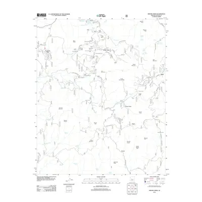
2012 Map of Groom Creek
USGS Topo · Published 2012About this map
Groom Creek and the surrounding Bradshaw Mountains are defined by a high-elevation network of camps, ranches, and water sources south of Prescott. The landscape is dotted with specialized institutions such as the Phoenix YMCA Camp, Camp Maripai, and the Church Assembly Campground, indicating a long-standing tradition of mountain retreats and summer education. Settlement patterns follow the winding path of the Hassayampa River and its tributaries, where small communities like Walker and Potato Patch are connected by forest service roads. Evidence of the region’s agricultural and resource-based past remains visible through the Old Dandrea Ranch and Storm Ranch, alongside the notable elevation of Mount Union. Several campgrounds, including Lower Wolf Creek Campground and Indian Creek Campground, highlight the shift toward recreation in this timbered terrain during the early 21st century.
Find a feature on this map
99 named features on this map. Tap any name to fly to it.
Don’t see what you’re looking for? This feature index may not catch every label — zoom into the map to look around manually.
Map Details
Editions of this 2012 Groom Creek Map
This is the sole edition of this map. No revisions or reprints were ever made.
Other maps of this area

1887 · Prescott
USGS Topo · 1:250,000

1892 · Prescott
USGS Topo · 1:250,000

1903 · Bradshaw Mountains
USGS Topo · 1:125,000

1903 · Congress
USGS Topo · 1:125,000

1904 · Congress
USGS Topo · 1:125,000

1905 · Jerome
USGS Topo · 1:125,000

1947 · Iron Springs
USGS Topo · 1:62,500

1947 · Mt. Union
USGS Topo · 1:62,500

1947 · Kirkland
USGS Topo · 1:62,500

1947 · Prescott
USGS Topo · 1:62,500