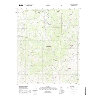
2018 Map of Groom Creek
USGS Topo · Published 2018About this map
The high ridges and deep drainages of the Bradshaw Mountains dominate this landscape within the Prescott National Forest. Settlements are clustered along the winding road network, including the mountain communities of Groom Creek, Walker, and the high-elevation enclave at Potato Patch. The terrain is marked by a legacy of resource extraction, evidenced by roads like Ruth Mine Rd and Old Miner Rd, as well as numerous gulches and ravines named for early settlers and industrial activity. Water is a critical feature in this arid upland, with Goldwater Lake in the north and the headwaters of the Hassayampa River cutting through the central portion of the quadrangle. Significant peaks such as Mt Union, Mt Davis, and Maverick Mtn provide the topographical framework for the region's isolated settlements and scattered springs like Independent Spring and Dosoris Spring.
Find a feature on this map
106 named features on this map. Tap any name to fly to it.
Don’t see what you’re looking for? This feature index may not catch every label — zoom into the map to look around manually.
Map Details
Editions of this 2018 Groom Creek Map
This is the sole edition of this map. No revisions or reprints were ever made.
Other maps of this area

1887 · Prescott
USGS Topo · 1:250,000

1892 · Prescott
USGS Topo · 1:250,000

1903 · Bradshaw Mountains
USGS Topo · 1:125,000

1903 · Congress
USGS Topo · 1:125,000

1904 · Congress
USGS Topo · 1:125,000

1905 · Jerome
USGS Topo · 1:125,000

1947 · Iron Springs
USGS Topo · 1:62,500

1947 · Mt. Union
USGS Topo · 1:62,500

1947 · Kirkland
USGS Topo · 1:62,500

1947 · Prescott
USGS Topo · 1:62,500