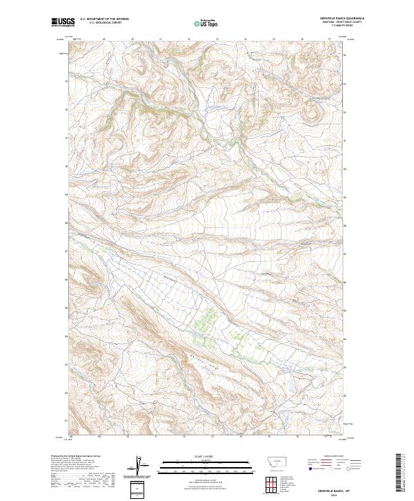
2024 Map of Grosfield Ranch
USGS Topo · Published 2024About this map
Big Timber Creek and its complex network of tributaries dominate this Sweet Grass County landscape, revealing a high-country terrain defined by water management and ranching access. The map highlights the Big Timber Creek Canal and the Beley Ditch, infrastructure essential for directing mountain runoff through the drainages of Bear Gulch and Long Gulch. These watercourses, along with South Fork Big Timber Creek and Whitetail Creek, shape the local topography around the prominent Whitetail Ridge.
Find a feature on this map
21 named features on this map. Tap any name to fly to it.
Don’t see what you’re looking for? This feature index may not catch every label — zoom into the map to look around manually.
Map Details
Editions of this 2024 Grosfield Ranch Map
This is the sole edition of this map. No revisions or reprints were ever made.
Other maps of this area

1886 · Little Belt Mts.
USGS Topo · 1:250,000

1889 · Big Snowy Mountain
USGS Topo · 1:250,000

1891 · Livingston
USGS Topo · 1:250,000

1891 · Big Timber
USGS Topo · 1:125,000

1893 · Livingston
USGS Topo · 1:250,000

1893 · Big Snowy Mountain
USGS Topo · 1:250,000

1893 · Big Timber
USGS Topo · 1:125,000

1894 · Little Belt Mts.
USGS Topo · 1:250,000

1897 · Little Belt Mts.
USGS Topo · 1:250,000

1898 · Little Belt Mts.
USGS Topo · 1:250,000