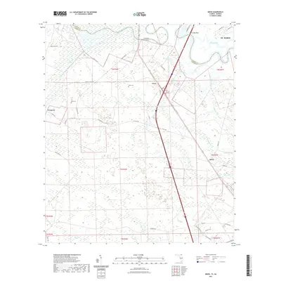
2021 Map of Gross
USGS Topo · Published 2021About this map
The Saint Marys River carves a winding path along the state line between Georgia and Florida, anchoring a landscape defined by extensive wetlands and small rural settlements. This 2021 survey details the coastal lowlands of Nassau County, Florida, and Camden County, Georgia, where the river meets complex drainage systems like White Oak Swamp and Plummer Swamp. The area’s geography is shaped by these watercourses, including the north-flowing Lofton Creek and McQueen Creek.
Find a feature on this map
51 named features on this map. Tap any name to fly to it.
Don’t see what you’re looking for? This feature index may not catch every label — zoom into the map to look around manually.
Map Details
Editions of this 2021 Gross Map
This is the sole edition of this map. No revisions or reprints were ever made.
Other maps of this area

1917 · Boulogne
USGS Topo · 1:62,500

1917 · Hilliard
USGS Topo · 1:62,500

1918 · St Marys
USGS Topo · 1:62,500

1918 · Kingsland
USGS Topo · 1:62,500

1919 · St Marys
USGS Topo · 1:62,500

1919 · Hilliard
USGS Topo · 1:62,500

1919 · Boulogne
USGS Topo · 1:62,500

1948 · Jacksonville
USGS Topo · 1:250,000

1957 · Jacksonville
USGS Topo · 1:250,000

1958 · Gross
USGS Topo · 1:24,000