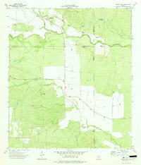
1974 Map of Gross Tank
USGS Topo · Published 1977About this map
Frio River and Blanco Creek define this rural South Texas landscape, where the confluence of several watercourses historically dictated land use and ranching boundaries. By the mid-1970s, the terrain was marked by a network of ranching infrastructure and early industrial development. Three distinct reservoirs, Gross Tank, Catfish Tank, and several unnamed water bodies, provide critical water sources in this arid region. The map reveals an evolving economy through the presence of scattered Gas Wells and Storage Bins, while multiple Landing Strips suggest the necessity of aerial access for large property management. Historically significant markers like Windmill No 16 and Windmill No 15 appear alongside the winding path of Elm Creek and the seasonally defined Night Holler Creek.
Find a feature on this map
17 named features on this map. Tap any name to fly to it.
Don’t see what you’re looking for? This feature index may not catch every label — zoom into the map to look around manually.
Map Details
Editions of this 1974 Gross Tank Map
This is the sole edition of this map. No revisions or reprints were ever made.
Other maps of this area

1898 · Uvalde
USGS Topo · 1:125,000

1899 · Uvalde
USGS Topo · 1:125,000

1928 · Frio Town
USGS Topo · 1:62,500

1942 · Divot
USGS Topo · 1:62,500

1953 · Crystal City
USGS Topo · 1:250,000

1954 · San Antonio
USGS Topo · 1:250,000

1955 · Crystal City
USGS Topo · 1:250,000

1956 · Divot
USGS Topo · 1:62,500

1957 · San Antonio
USGS Topo · 1:250,000

1957 · Batesville
USGS Topo · 1:62,500