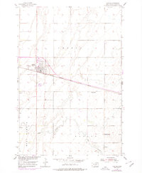
1954 Map of Groton
USGS Topo · Published 1978About this map
Groton dominates this mid-century survey of Brown County, situated at the junction of regional transport lines as part of the Department of the Interior's Missouri River Basin development program. The town's grid is established adjacent to the Chicago Milwaukee St Paul and Pacific railroad, which cuts a straight path southeast through the prairie. Agricultural land use is evident in the rural sections of Groton and West Hanson townships, where scattered features such as a solitary Windmill and the Prairie Side Sch suggest a landscape of isolated homesteads and local community hubs. To the south, the meandering course of Mud Creek contrasts with the rigid township lines, providing a natural drainage system for the surrounding plains. Notable landmarks for local history include the Groton Cem on the town's northern edge and a Flowing Well positioned near the center of the quadrangle.
Find a feature on this map
9 named features on this map. Tap any name to fly to it.
Don’t see what you’re looking for? This feature index may not catch every label — zoom into the map to look around manually.
Map Details
Editions of this 1954 Groton Map
2 editions found
Other maps of this area

1895 · Aberdeen
USGS Topo · 1:125,000

1896 · Columbia
USGS Topo · 1:125,000

1952 · Huffton
USGS Topo · 1:24,000

1952 · Putney
USGS Topo · 1:24,000

1953 · Groton SW
USGS Topo · 1:24,000

1953 · Milbank
USGS Topo · 1:250,000

1954 · Groton
USGS Topo · 1:24,000

1954 · James
USGS Topo · 1:24,000

1954 · Ferney
USGS Topo · 1:24,000

1954 · Aberdeen
USGS Topo · 1:250,000