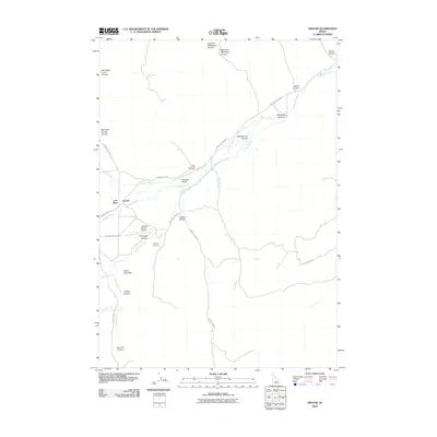
2010 Map of Grouse
USGS Topo · Published 2010About this map
Antelope Valley and the Lost River basin are defined here by a network of drainage canyons and high-desert landmarks in Custer County. The small settlement of Grouse sits at the junction of Antelope Creek and Cherry Creek, serving as a focal point for the surrounding ranching and transport routes like Antelope Creek Rd. To the south, the Antelope Valley Airport and Antelope Cemetery provide evidence of local infrastructure and community history within this remote landscape.
Find a feature on this map
33 named features on this map. Tap any name to fly to it.
Don’t see what you’re looking for? This feature index may not catch every label — zoom into the map to look around manually.
Map Details
Editions of this 2010 Grouse Map
This is the sole edition of this map. No revisions or reprints were ever made.
Other maps of this area

1935 · MacKay
USGS Topo · 1:96,000

1940 · Mackay
USGS Topo · 1:62,500

1955 · Idaho Falls
USGS Topo · 1:250,000

1958 · Idaho Falls
USGS Topo · 1:250,000

1960 · Grouse
USGS Topo · 1:62,500

1960 · Mackay
USGS Topo · 1:62,500

1969 · Darlington
USGS Topo · 1:24,000

1972 · Nichols Reservoir
USGS Topo · 1:24,000

1972 · Appendicitis Hill
USGS Topo · 1:24,000
1988 · Arco
USGS Topo · 1:100,000