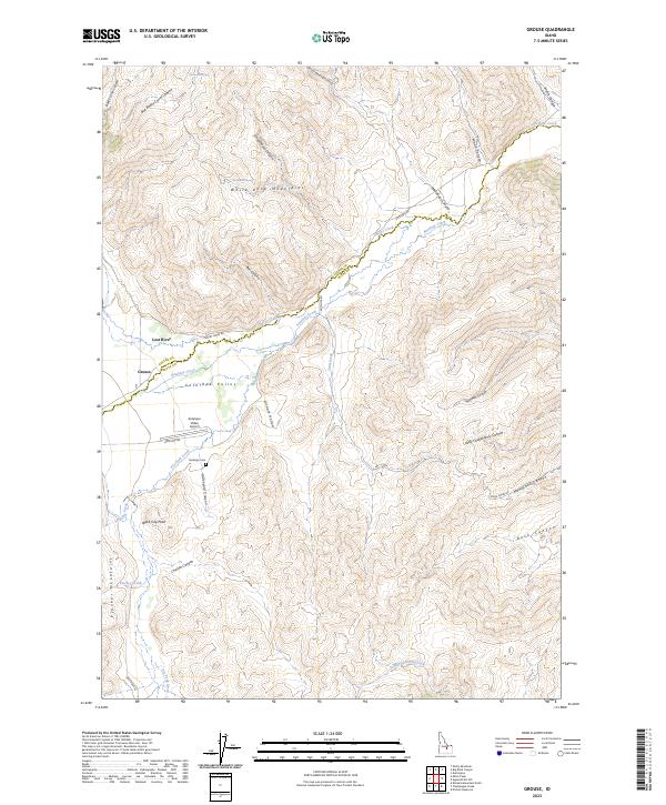
2023 Map of Grouse
USGS Topo · Published 2023About this map
Grouse sits at the northern edge of the Antelope Valley, a high-elevation mountain basin where the boundaries of Custer and Butte counties meet. This ranching landscape is defined by its drainage patterns, with Antelope Creek flowing through the valley floor and Dry Fork Creek descending from the south near the Pioneer Mountains. Historically significant to local families and researchers, the area includes the Antelope Cem located just east of Graveyard Canyon. The map reveals a remote pastoral economy supported by the Antelope Valley Airport and a network of named drainages like Cherry Creek and Trail Creek that sustain the high desert rangeland.
Find a feature on this map
1 named feature on this map. Tap any name to fly to it.
Don’t see what you’re looking for? This feature index may not catch every label — zoom into the map to look around manually.
Map Details
Editions of this 2023 Grouse Map
This is the sole edition of this map. No revisions or reprints were ever made.
Other maps of this area

1935 · MacKay
USGS Topo · 1:96,000

1940 · Mackay
USGS Topo · 1:62,500

1955 · Idaho Falls
USGS Topo · 1:250,000

1958 · Idaho Falls
USGS Topo · 1:250,000

1960 · Grouse
USGS Topo · 1:62,500

1960 · Mackay
USGS Topo · 1:62,500

1969 · Darlington
USGS Topo · 1:24,000

1972 · Nichols Reservoir
USGS Topo · 1:24,000

1972 · Appendicitis Hill
USGS Topo · 1:24,000
1988 · Arco
USGS Topo · 1:100,000