
1960 Map of Grouse
USGS Topo · Published 1961About this map
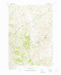
Antelope Valley serves as the central hub of this mid-century survey, where the small community of Grouse sits alongside Antelope Creek. The map documents a transition from active ranching and community life to archaeological traces of the mining era, evidenced by the presence of the Grouse Sch and Antelope Cem contrast against the nearby Era (Site) and Martin (Site). These former settlements were likely tied to the cluster of mineral claims in the southeastern hills, including the Reliance Mine, St Louis Mine, and the Golden Chariot Mine.
Find a feature on this map
115 named features on this map. Tap any name to fly to it.
Don’t see what you’re looking for? This feature index may not catch every label — zoom into the map to look around manually.
Map Details
Editions of this 1960 Grouse Map
2 editions found
Other maps of this area

1935 · MacKay
USGS Topo · 1:96,000

1940 · Mackay
USGS Topo · 1:62,500

1955 · Idaho Falls
USGS Topo · 1:250,000

1958 · Idaho Falls
USGS Topo · 1:250,000

1960 · Muldoon Canyon
USGS Topo · 1:62,500

1960 · Mackay
USGS Topo · 1:62,500

1960 · Copper Basin
USGS Topo · 1:62,500

1969 · Darlington
USGS Topo · 1:24,000

1972 · Nichols Reservoir
USGS Topo · 1:24,000

1972 · Inferno Cone
USGS Topo · 1:24,000