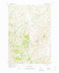
1960 Map of Grouse
USGS Topo · Published 1975About this map
Antelope Valley serves as the central corridor for this 1960s survey of high-desert terrain, where the small community of Grouse and the nearby Grouse Sch sit along Antelope Creek. The landscape transition is evident where the Challis National Forest meets the expansive Lava beds to the southeast. This region's mid-century economic character is defined by a cluster of mineral interests in the foothills, including the Envy Mine, Oxide Lode Mine, and Valley Arco Mine.
Find a feature on this map
104 named features on this map. Tap any name to fly to it.
Don’t see what you’re looking for? This feature index may not catch every label — zoom into the map to look around manually.
Map Details
Editions of this 1960 Grouse Map
2 editions found
Other maps of this area

1935 · MacKay
USGS Topo · 1:96,000

1940 · Mackay
USGS Topo · 1:62,500

1955 · Idaho Falls
USGS Topo · 1:250,000

1958 · Idaho Falls
USGS Topo · 1:250,000

1960 · Muldoon Canyon
USGS Topo · 1:62,500

1960 · Grouse
USGS Topo · 1:62,500

1960 · Mackay
USGS Topo · 1:62,500

1960 · Copper Basin
USGS Topo · 1:62,500

1969 · Darlington
USGS Topo · 1:24,000

1972 · Nichols Reservoir
USGS Topo · 1:24,000