
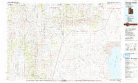
1987 Map of Grouse Creek
USGS Topo · Published 1987About this map
Sawtooth National Forest dominates the northern reaches of this landscape, where the Raft River Mountains and Sawtooth Mountains create a high-altitude border between Utah and Idaho. The map captures a high-desert ranching and transit corridor defined by the Raft River Valley and the expansive Grouse Creek Valley. Small settlements such as Yost, Park Valley, and Rosette are isolated hubs connected by Highway 30, while the southern landscape descends toward the brine of the Great Salt Lake and the shifting terrain of Mud Flat.
Find a feature on this map
53 named features on this map. Tap any name to fly to it.
Don’t see what you’re looking for? This feature index may not catch every label — zoom into the map to look around manually.
Map Details
Editions of this 1987 Grouse Creek Map
2 editions found
Other maps of this area

1954 · Pocatello
USGS Topo · 1:250,000

1954 · Brigham City
USGS Topo · 1:250,000

1955 · Twin Falls
USGS Topo · 1:250,000

1955 · Wells
USGS Topo · 1:250,000

1958 · Wells
USGS Topo · 1:250,000

1958 · Twin Falls
USGS Topo · 1:250,000

1958 · Pocatello
USGS Topo · 1:250,000

1958 · Brigham City
USGS Topo · 1:250,000

1959 · Strevell
USGS Topo · 1:62,500

1959 · Cotton Thomas Basin
USGS Topo · 1:62,500