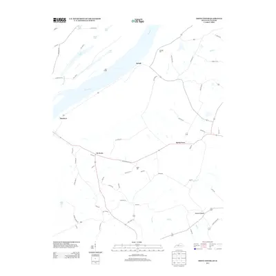
2013 Map of Grove Center
USGS Topo · Published 2013About this map
The Ohio River forms a wide curve at the northern edge of this Union County landscape, defining the boundary between Kentucky and Illinois. The river environment is characterized by significant backwater features, including the elongated Bell Island and a series of nearby lakes such as Big Lake, Black Lake, and Fehrer Lake. These water bodies and the adjacent Millrace Slough suggest a complex floodplain history shaped by the river's seasonal movements. To the south, the terrain rises toward several named elevations like Bald Hill and Grundy Hill. Settlement patterns follow the higher ground between creek drainages, with Grove Center and Spring Grove serving as local hubs. The road network connects small crossroads communities like Raleigh and Blackburn, while several family-named routes such as Hite Spece Rd and Hamilton Mine Rd hint at the area's agricultural and industrial heritage near the Cypress Cr watershed.
Find a feature on this map
61 named features on this map. Tap any name to fly to it.
Don’t see what you’re looking for? This feature index may not catch every label — zoom into the map to look around manually.
Map Details
Editions of this 2013 Grove Center Map
This is the sole edition of this map. No revisions or reprints were ever made.
Other maps of this area

1905 · New Haven
USGS Topo · 1:62,500

1906 · New Haven
USGS Topo · 1:62,500

1907 · Morganfield
USGS Topo · 1:62,500

1916 · Shawneetown
USGS Topo · 1:62,500

1917 · Uniontown
USGS Topo · 1:62,500

1949 · Paducah
USGS Topo · 1:250,000

1949 · New Haven
USGS Topo · 1:62,500

1949 · Morganfield
USGS Topo · 1:24,000

1950 · Paducah
USGS Topo · 1:250,000

1951 · Sturgis
USGS Topo · 1:24,000