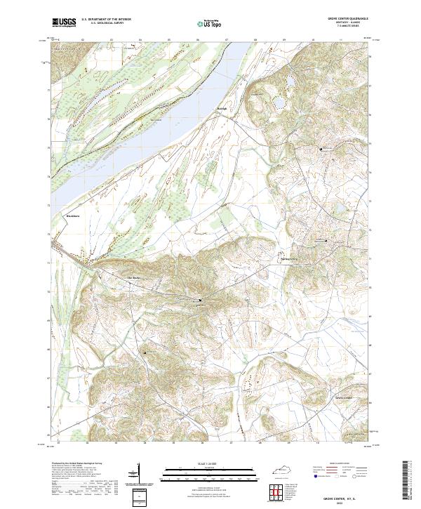
2022 Map of Grove Center
USGS Topo · Published 2022About this map
Raleigh and Blackburn anchor the northern reaches of this Union County landscape where the Ohio River forms the state boundary with Illinois. The terrain transitions from the low-lying wetlands of Bell Island and Millrace Slough to the prominent elevations of Grundy Hill and The Rocks. This modern survey reveals a countryside shaped by agriculture and drainage, featuring an intricate network of rural routes such as Clabber Alley Rd and Goose Pond Ditch.
Find a feature on this map
60 named features on this map. Tap any name to fly to it.
Don’t see what you’re looking for? This feature index may not catch every label — zoom into the map to look around manually.
Map Details
Editions of this 2022 Grove Center Map
This is the sole edition of this map. No revisions or reprints were ever made.
Other maps of this area

1905 · New Haven
USGS Topo · 1:62,500

1906 · New Haven
USGS Topo · 1:62,500

1907 · Morganfield
USGS Topo · 1:62,500

1916 · Shawneetown
USGS Topo · 1:62,500

1917 · Uniontown
USGS Topo · 1:62,500

1949 · Paducah
USGS Topo · 1:250,000

1949 · New Haven
USGS Topo · 1:62,500

1949 · Morganfield
USGS Topo · 1:24,000

1950 · Paducah
USGS Topo · 1:250,000

1951 · Sturgis
USGS Topo · 1:24,000