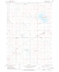
1973 Map of Grover
USGS Topo · Published 1978About this map
Glacial prairie potholes and extensive wetlands define the landscape between Kampeska and Brantford in this early 1970s survey. The map records a transition in regional transportation, showing the tracks of the Chicago and North Western and Burlington Northern railroads intersecting the rural grid. Much of the terrain is dedicated to conservation and recreation, including the Goose Lake State Public Shooting Area and the National Waterfowl Production Area, reflecting the importance of this flyway for migratory birds.
Find a feature on this map
20 named features on this map. Tap any name to fly to it.
Don’t see what you’re looking for? This feature index may not catch every label — zoom into the map to look around manually.
Map Details
Editions of this 1973 Grover Map
This is the sole edition of this map. No revisions or reprints were ever made.
Other maps of this area

1953 · Watertown
USGS Topo · 1:250,000

1958 · Watertown
USGS Topo · 1:250,000

1969 · Hayti
USGS Topo · 1:24,000

1969 · Watertown West
USGS Topo · 1:24,000

1969 · Pelican Lake
USGS Topo · 1:24,000
1973 · Henry
USGS Topo · 1:24,000

1973 · Bryant NE
USGS Topo · 1:24,000
1973 · Kampeska
USGS Topo · 1:24,000

1973 · Vienna East
USGS Topo · 1:24,000
1973 · Hazel
USGS Topo · 1:24,000