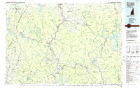
1986 Map of Groveton
USGS Topo · Published 1986About this map
The Connecticut River serves as the primary boundary and lifeline between New Hampshire and Vermont in this mid-1980s topographical study. The river valley facilitates major transit corridors including U.S. 3 and the Canadian National RR, connecting industrial and agricultural hubs like Groveton and Colebrook. To the east, the sprawling White Mountain National Forest and Nash Stream State Forest dominate the terrain, while the western side features Vermont’s Maidstone Lake and the Victory State Forest.
Find a feature on this map
299 named features on this map. Tap any name to fly to it.
Don’t see what you’re looking for? This feature index may not catch every label — zoom into the map to look around manually.
Map Details
Editions of this 1986 Groveton Map
2 editions found
Other maps of this area

1893 · Mt. Washington
USGS Topo · 1:62,500

1893 · Gorham
USGS Topo · 1:62,500

1896 · Mt. Washington
USGS Topo · 1:62,500

1896 · Gorham
USGS Topo · 1:62,500

1900 · Whitefield
USGS Topo · 1:62,500

1914 · Bethel
USGS Topo · 1:62,500

1919 · Lake Memphremagog
USGS Topo · 1:62,500

1920 · Derby
USGS Topo · 1:62,500

1920 · Guildhall
USGS Topo · 1:62,500

1923 · Lake Memphremagog
USGS Topo · 1:48,000