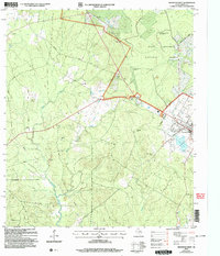
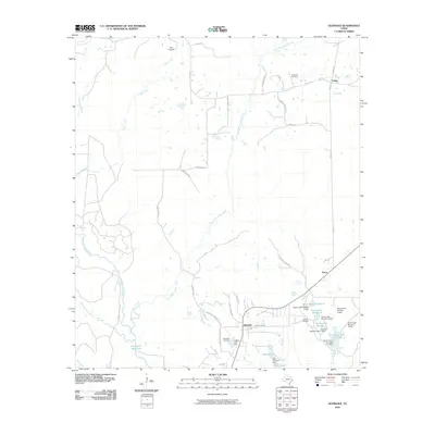
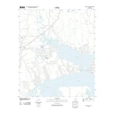
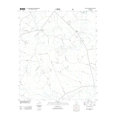
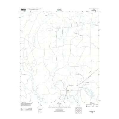
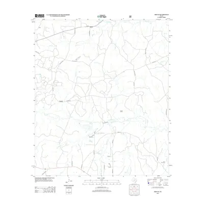
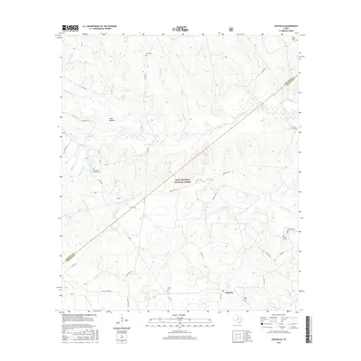
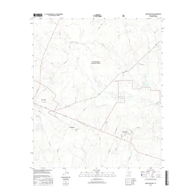
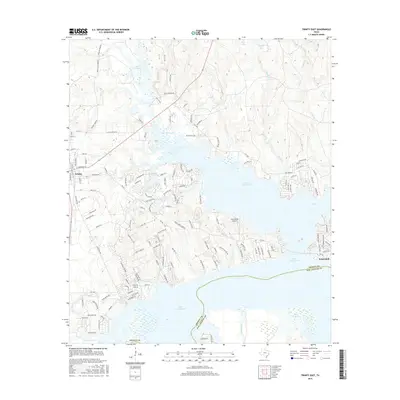
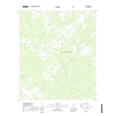
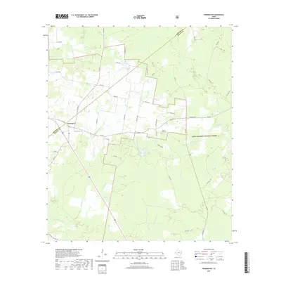
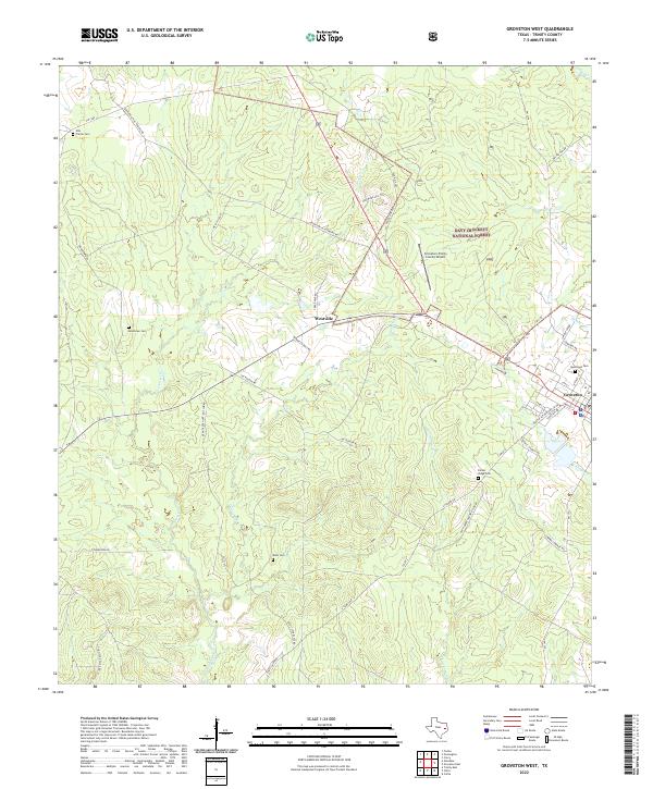
2004 Map of Groveton West
USGS Topo · Published 2006About this map
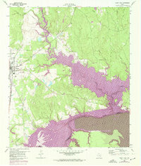
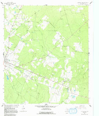
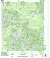
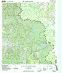
Davy Crockett National Forest dominates the northeast quadrant of this West Texas landscape, bordering the established community of Groveton. This 2004 revision reveals a terrain marked by small, family-oriented landmarks such as Ellis Prairie Cem, Boontown Cem, and New Light Ch. The map captures the transition from the wooded forest areas to the Flat Prairie in the northwest, where rural routes like Groveton Road and Walter Dial Road provide local access. To the south and east, the drainage of Caney Creek, White Oak Creek, and Kickapoo Creek defines the local hydrology, feeding into Avery Lake near the edge of town. For genealogists, the density of named cemeteries including Dean Cem, Parker Ridge Cem, and Glenwood Cem provides a clear spatial record of the area's rural heritage and local family history.
Find a feature on this map
25 named features on this map. Tap any name to fly to it.
Don’t see what you’re looking for? This feature index may not catch every label — zoom into the map to look around manually.
Map Details
Editions of this 2004 Groveton West Map
This is the sole edition of this map. No revisions or reprints were ever made.
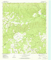
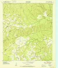
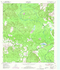
Historical Maps of Groveton Through Time
72 maps found
1950 Centralia
Trinity County, TX
1951 Centralia
Trinity County, TX
1951 Wells SW
Trinity County, TX
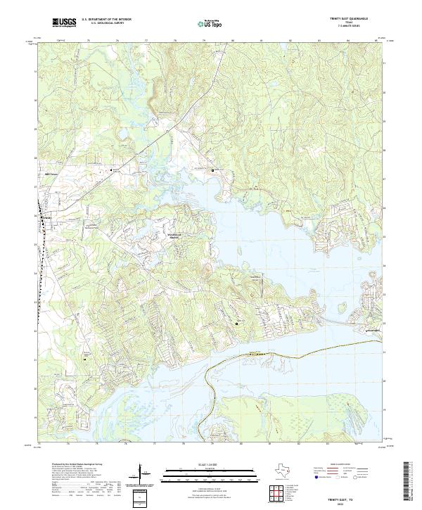
1960 Trinity East
Trinity County, TX
1962 Glendale
Trinity County, TX
1963 Apple Springs
Trinity County, TX
1963 Crecy
Trinity County, TX
1963 Groveton East
Trinity County, TX
1963 Groveton West
Trinity County, TX
1963 Pennington
Trinity County, TX
1963 Trevat
Trinity County, TX
2004 Centralia
Trinity County, TX
2004 Crecy
Trinity County, TX
2004 Groveton East
Trinity County, TX
2004 Groveton West
Trinity County, TX
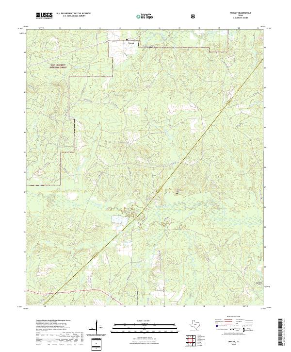
2004 Trevat
Trinity County, TX
2004 Wells SW
Trinity County, TX
2010 Apple Springs
Trinity County, TX
2010 Centralia
Trinity County, TX
2010 Chita
Trinity County, TX
2010 Glendale
Trinity County, TX
2010 Groveton East
Trinity County, TX
2010 Groveton West
Trinity County, TX
2010 Trevat
Trinity County, TX
2010 Trinity East
Trinity County, TX
2010 Wells SW
Trinity County, TX
2011 Crecy
Trinity County, TX
2011 Pennington
Trinity County, TX
2013 Apple Springs
Trinity County, TX
2013 Centralia
Trinity County, TX
2013 Chita
Trinity County, TX
2013 Crecy
Trinity County, TX
2013 Glendale
Trinity County, TX
2013 Groveton East
Trinity County, TX
2013 Groveton West
Trinity County, TX
2013 Pennington
Trinity County, TX
2013 Trevat
Trinity County, TX
2013 Trinity East
Trinity County, TX
2013 Wells SW
Trinity County, TX
2016 Apple Springs
Trinity County, TX
2016 Centralia
Trinity County, TX
2016 Chita
Trinity County, TX
2016 Crecy
Trinity County, TX
2016 Glendale
Trinity County, TX
2016 Groveton East
Trinity County, TX
2016 Groveton West
Trinity County, TX
2016 Pennington
Trinity County, TX
2016 Trevat
Trinity County, TX
2016 Trinity East
Trinity County, TX
2016 Wells SW
Trinity County, TX

2019 Apple Springs
Trinity County, TX
2019 Centralia
Trinity County, TX
2019 Chita
Trinity County, TX
2019 Crecy
Trinity County, TX
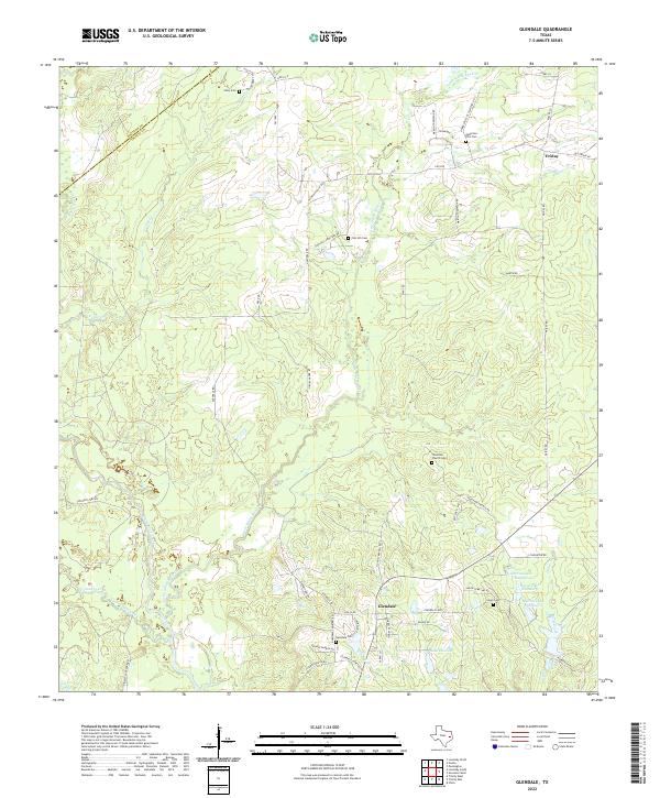
2019 Glendale
Trinity County, TX
2019 Groveton East
Trinity County, TX
2019 Groveton West
Trinity County, TX
2019 Pennington
Trinity County, TX
2019 Trevat
Trinity County, TX
2019 Trinity East
Trinity County, TX
2019 Wells SW
Trinity County, TX
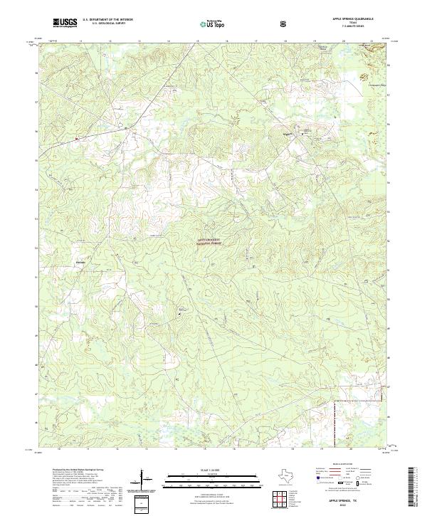
2022 Apple Springs
Trinity County, TX
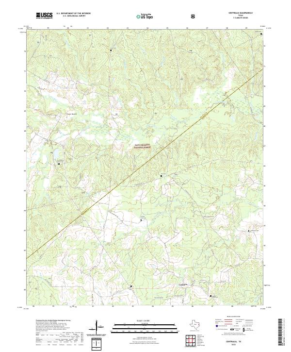
2022 Centralia
Trinity County, TX
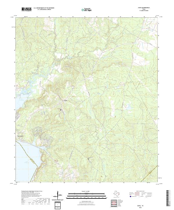
2022 Chita
Trinity County, TX
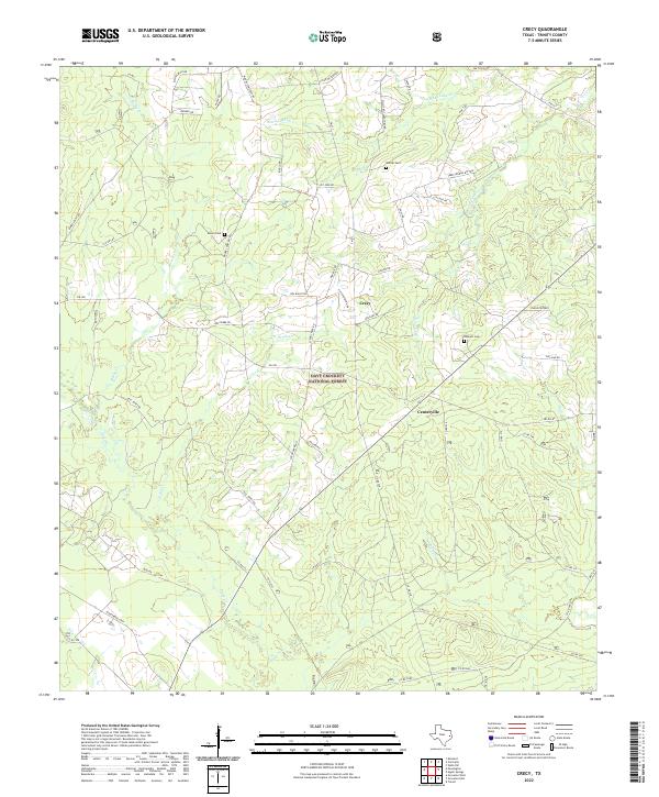
2022 Crecy
Trinity County, TX
2022 Glendale
Trinity County, TX
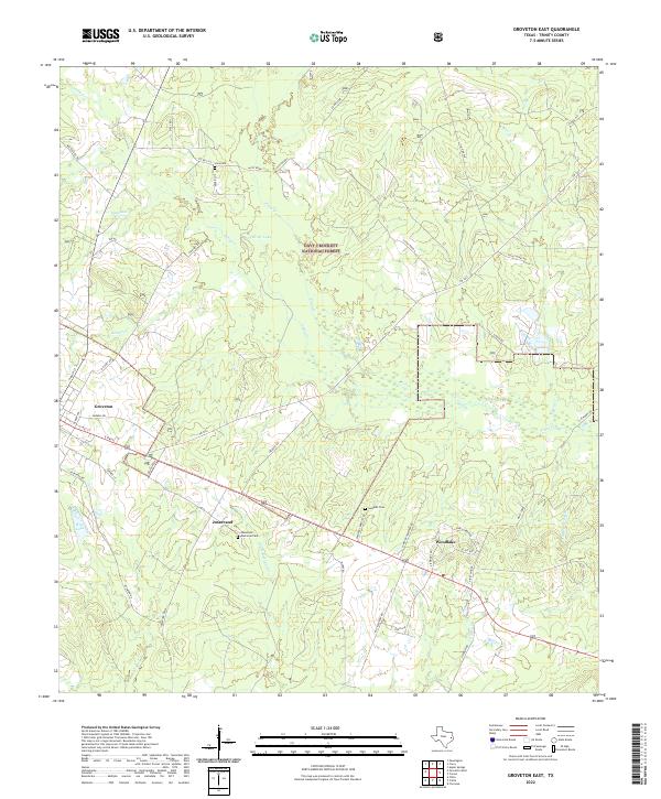
2022 Groveton East
Trinity County, TX
2022 Groveton West
Trinity County, TX
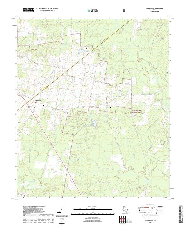
2022 Pennington
Trinity County, TX
2022 Trevat
Trinity County, TX
2022 Trinity East
Trinity County, TX
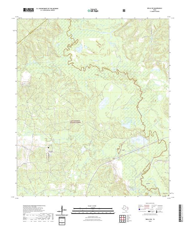
2022 Wells SW
Trinity County, TX