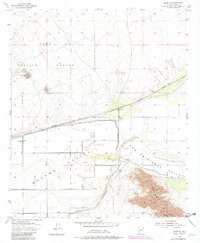
1955 Map of Growler
USGS Topo · Published 1982About this map
The Gila River corridor defines this arid landscape in Yuma County, where agriculture and infrastructure meet the desert floor. The Southern Pacific railroad runs parallel to the Mohawk Canal and a system of levees designed to manage the seasonal flows of the river and its surrounding valleys. Civil engineering is a dominant theme of the era, seen in the irrigation network that supports the San Cristobal Valley and Mohawk Valley.
Find a feature on this map
34 named features on this map. Tap any name to fly to it.
Don’t see what you’re looking for? This feature index may not catch every label — zoom into the map to look around manually.
Map Details
Editions of this 1955 Growler Map
3 editions found
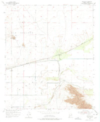
Other maps of this area

1926 · Mohawk
USGS Topo · 1:62,500

1927 · Kim
USGS Topo · 1:62,500

1928 · Mohawk
USGS Topo · 1:62,500

1928 · Norton
USGS Topo · 1:62,500

1929 · Norton
USGS Topo · 1:62,500

1930 · Stoval
USGS Topo · 1:62,500

1931 · Kim
USGS Topo · 1:62,500

1950 · Stoval
USGS Topo · 1:62,500

1953 · Ajo
USGS Topo · 1:250,000

1955 · Growler
USGS Topo · 1:24,000