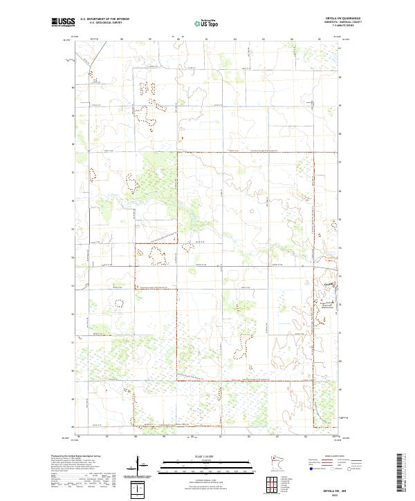
2022 Map of Grygla SW
USGS Topo · Published 2022About this map
Grygla sits at the eastern edge of this Marshall County landscape, where the Mud River winds through a terrain defined by extensive wetlands and a geometric grid of rural roads. The area is a hub for regional recreation, as evidenced by the extensive network of the Fourtown-Grygla Trail System Trl and the Consolidated Conservation Trails Trl that traverse the marshy sections between township lines. This 2022 survey captures the modern infrastructure supporting this remote settlement, including the Grygla Municipal Airport-Mel Wilkens Field. The land division follows the Public Land Survey System, with roads like 300th St NE and Co Hwy 53 providing the primary structure for the scattered farmsteads and conservation areas that characterize this part of northern Minnesota.
Find a feature on this map
24 named features on this map. Tap any name to fly to it.
Don’t see what you’re looking for? This feature index may not catch every label — zoom into the map to look around manually.
Map Details
Editions of this 2022 Grygla SW Map
This is the sole edition of this map. No revisions or reprints were ever made.
Other maps of this area

1918 · Rollis
USGS Topo · 1:62,500

1919 · Liner
USGS Topo · 1:62,500

1943 · Rollis
USGS Topo · 1:62,500

1954 · Roseau
USGS Topo · 1:250,000

1957 · Roseau
USGS Topo · 1:250,000

1958 · Roseau
USGS Topo · 1:250,000

1962 · Gatzke SE
USGS Topo · 1:24,000

1962 · Gatzke
USGS Topo · 1:24,000
1972 · Goodridge
USGS Topo · 1:24,000
1973 · Grygla
USGS Topo · 1:24,000