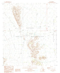
1990 Map of Gu Vo
USGS Topo · Published 1990About this map
Papago Indian Reservation territory defines this desert landscape, where the settlement of Gu Vo sits at a strategic gap between two major sections of the Gu Vo Hills. Mapping reveals a community structured around water management and movement through the Gu Vo Pass, connecting the Barajita Valley to the west with the Quijotoa Valley to the east. The presence of numerous Check Dams and a Levee near the Wash underscores the vital role of hydrological engineering in this arid environment. To the south, the smaller settlement of Pia lies near the southern reach of the hills, while a local Cemetery and Kerwo Well provide specific points of interest for genealogists and local historians tracing the physical layout of the Tohono O'odham Nation's lands as they were documented in the late twentieth century.
Find a feature on this map
17 named features on this map. Tap any name to fly to it.
Don’t see what you’re looking for? This feature index may not catch every label — zoom into the map to look around manually.
Map Details
Editions of this 1990 Gu Vo Map
This is the sole edition of this map. No revisions or reprints were ever made.
Other maps of this area

1953 · Ajo
USGS Topo · 1:250,000

1954 · Sonoyta
USGS Topo · 1:250,000

1957 · Ajo
USGS Topo · 1:250,000

1958 · Ajo
USGS Topo · 1:250,000

1962 · Ajo
USGS Topo · 1:250,000

1963 · Ajo
USGS Topo · 1:250,000

1963 · Kom Vo
USGS Topo · 1:62,500

1963 · Mt. Ajo
USGS Topo · 1:62,500

1963 · Pisinimo
USGS Topo · 1:62,500

1963 · Lukeville
USGS Topo · 1:250,000