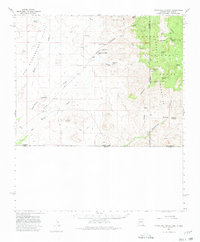
1958 Map of Guadalupe Canyon
USGS Topo · Published 1980About this map
The San Bernardino Valley stretches across this borderlands region, defined by the seasonal flow of the Black Draw and the rugged eastern ascent into the Peloncillo Mountains. This 1958 survey captures a remote ranching landscape where life centered on scattered springs and reliable water sources. Vital community landmarks like the Cottonwood Creek School and Cottonwood Creek Cemetery are situated near the Line V7 Ranch, serving the families who managed cattle across the arid drainages of Cottonwood Creek and Sycamore Creek.
Find a feature on this map
41 named features on this map. Tap any name to fly to it.
Don’t see what you’re looking for? This feature index may not catch every label — zoom into the map to look around manually.
Map Details
Editions of this 1958 Guadalupe Canyon Map
3 editions found

Other maps of this area

1917 · Chiricahua
USGS Topo · 1:125,000

1918 · Cienega Springs
USGS Topo · 1:62,500

1918 · Animas Peak
USGS Topo · 1:62,500

1919 · Perilla
USGS Topo · 1:125,000

1919 · Chiricahua
USGS Topo · 1:125,000

1920 · Animas Peak
USGS Topo · 1:62,500

1922 · McDonald
USGS Topo · 1:62,500

1926 · Pedregosa
USGS Topo · 1:62,500

1940 · Apache
USGS Topo · 1:62,500

1940 · College Peaks
USGS Topo · 1:62,500